
Tamil Nadu land records
View TSLR Sketch Online in Tamil Nadu (நகர நில அளவை வரைபடம்)
View a TSLR sketch online for an urban Tamil Nadu parcel — the town survey drawing of its measured shape and boundaries. Checking is free, and a price appears only when a complete sketch is ready.
Search the record
Fetching your record
Usually done in under 30 seconds.
Keep this tab open while we fetch your record.
What we're fetching
Progress
0:00
Your order
Result
You have not been charged. ₹0.
Use cases
- Checking an urban boundary
- Comparing a survey layout
- Reviewing adjoining references
Overview
TSLR Sketch overview
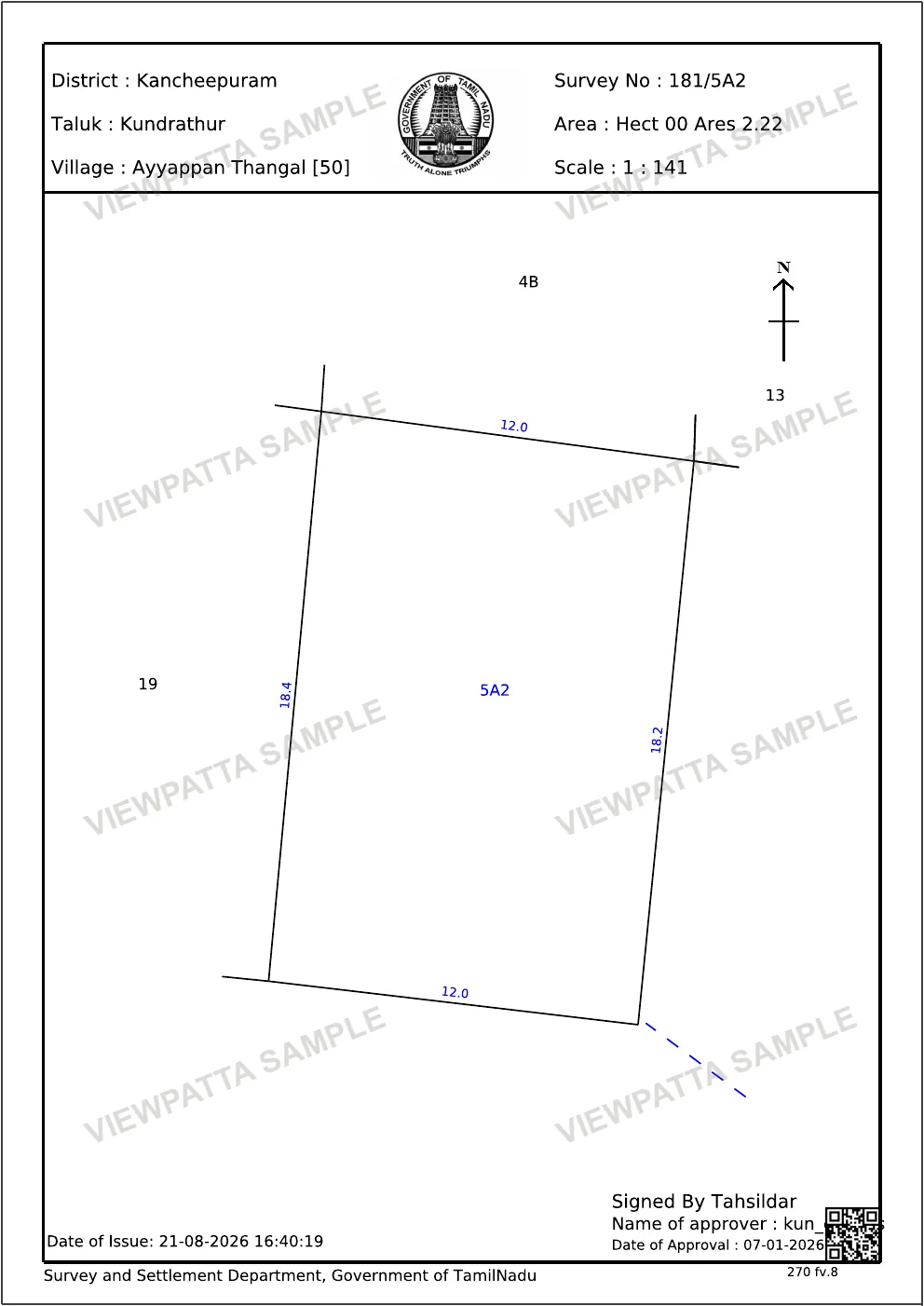
A TSLR Sketch (நகர நில அளவை வரைபடம்) is an urban survey drawing that represents the measured shape and boundaries of a town survey parcel, filed under the town, ward and block that the parcel sits in. It can show dimensions, adjoining survey references and the layout used by the urban land records system. Buyers and owners use it to compare a town survey boundary with other property documents and the physical site. It answers a boundary question only: the holder, extent and classification recorded for the same parcel live on the TSLR extract. A TSLR Sketch is a survey reference, not proof of title by itself, and it covers one parcel rather than a whole town. viewpatta helps you request the relevant sketch using the town survey and location details.
Record guide
What do the terms mean?
- TSLR sketch
- An urban survey drawing showing the measured shape and boundary references of a town-survey parcel.
- Adjoining parcel
- A neighbouring survey reference shown in the urban layout.
- Boundary measurement
- A recorded dimension or edge used to represent the surveyed parcel.
- Ward and block
- The town divisions a sketch is filed under, given alongside the town survey number.
Troubleshooting
Why might the result not appear?
- The town survey reference does not match the urban property document.
- The wrong ward, block or town was selected.
- The sketch is being compared with a rural FMB record instead of a TSLR extract.
- The recorded layout does not match the physical site and needs professional survey review.
- A map of the whole town is expected, but a sketch covers one town survey number.
What this record cannot establish
A TSLR sketch is a boundary and survey reference. It does not by itself establish title, possession, current occupation or planning permission.
Verification checklist
How to use this record
- Match the town, ward, block and town survey reference.
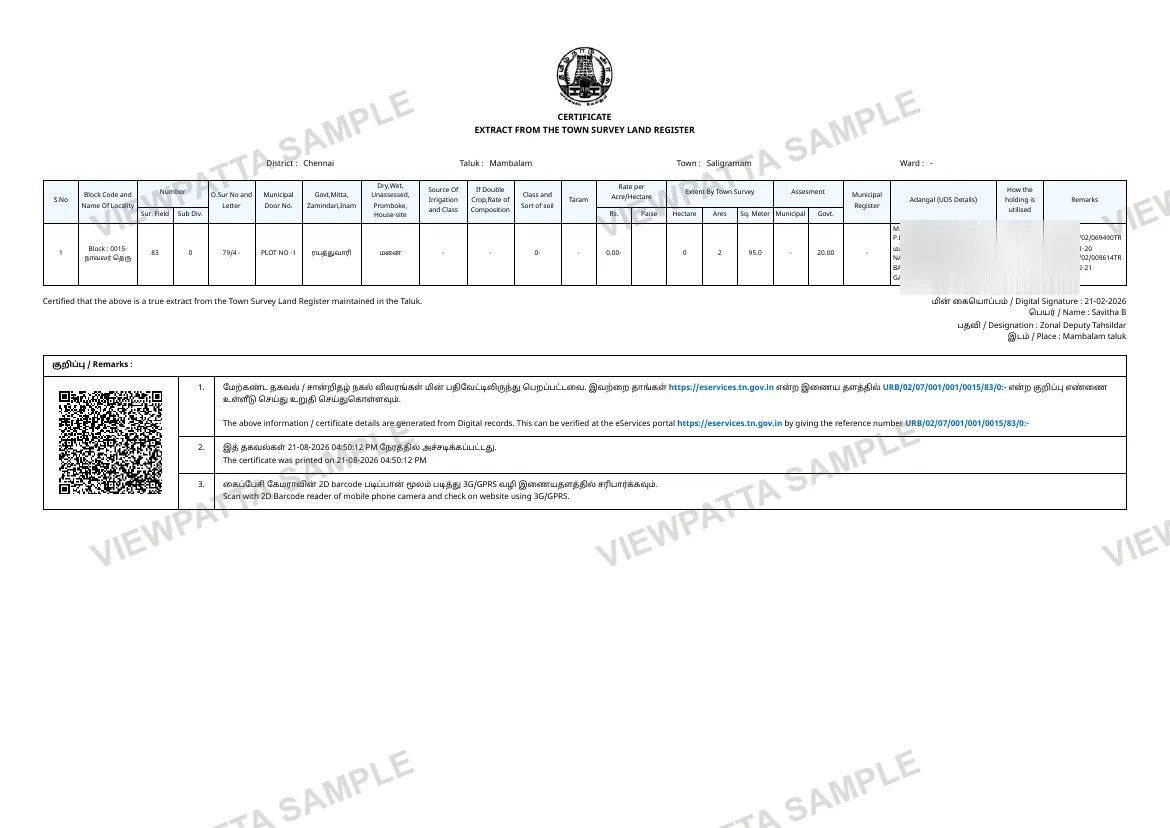
- Compare boundary measurements and adjoining parcels with the TSLR extract.
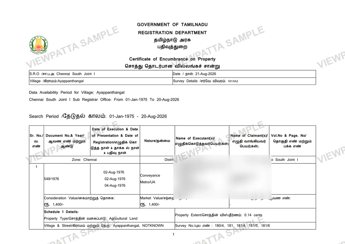
- Check the sketch against the registered deed and site conditions.
- Use a licensed surveyor when a boundary difference could affect a transaction.
Search help
What details should you keep ready?
Keep the town, ward, block and town survey reference ready. A TSLR sketch is tied to the urban survey details for the parcel.
Guides
Read before you search
Related tools
Continue checking the property
Questions
Before you start.
Including the two most people ask: whether we are the government, and what happens if the record is not there.
What is a TSLR sketch?
A TSLR sketch is an urban survey drawing representing the measured shape, boundaries and adjoining references of a town-survey parcel.
What details do I need to search for a TSLR sketch?
Keep the town, ward, block and town survey reference from the urban property documents ready.
Is a TSLR sketch the same as an FMB sketch?
Both are survey drawings, but FMB generally relates to rural field measurements while TSLR sketches relate to urban town-survey parcels.
Can a TSLR sketch prove a property boundary?
It shows the recorded survey layout and measurements, but an on-ground boundary question may require a licensed survey and should be reconciled with the deed and other records.
Should I get the TSLR sketch or the TSLR extract?
Take the sketch when the question is about shape, dimensions or where a boundary runs. Take the extract when the question is about who is recorded, how much land there is or how it is classified. Many urban checks want both.
Is a TSLR sketch a map of the whole town?
No. A sketch covers one town survey number and its immediate neighbours. A town-wide map is a different record and is not what this search returns.
Can I download a TSLR sketch as a PDF?
Yes. Checking whether the drawing can be prepared costs nothing, and a price appears only when it can. The PDF is available to download after the order is paid.